| Home > Maps > Hillsborough County > 1859 Map | |
|
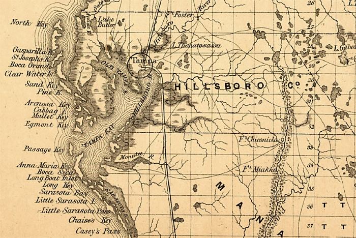
Detail
view of Hillsboro County and the Tampa Bay region from a map of Florida
showing drainage, cities, railroads, and the locations and six and fifteen
mile limits of the land grant railroads. The map is from the annual report
of the Surveyor General in 1859.
|
|
Map Credit: Courtesy of the Library of Congress, Geography and Map Division.
|
| Home > Maps > Hillsborough County > 1859 Map |
Exploring
Florida: A Social Studies Resource for Students and Teachers
Produced by the Florida Center for Instructional
Technology,
College of Education, University of South Florida © 2002.