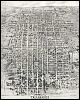
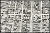
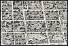
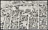
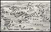
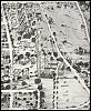
| Home > Maps > Leon City and Local Maps > Aerial View of Tallahassee, 1926 | |
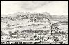
Click on a thumbnail sketch to view the full picture.
| Home > Maps > Leon City and Local Maps > Aerial View of Tallahassee, 1926 |
Exploring
Florida: A Social Studies Resource for Students and Teachers
Produced by the Florida Center for Instructional
Technology,
College of Education, University of South Florida ©2004.